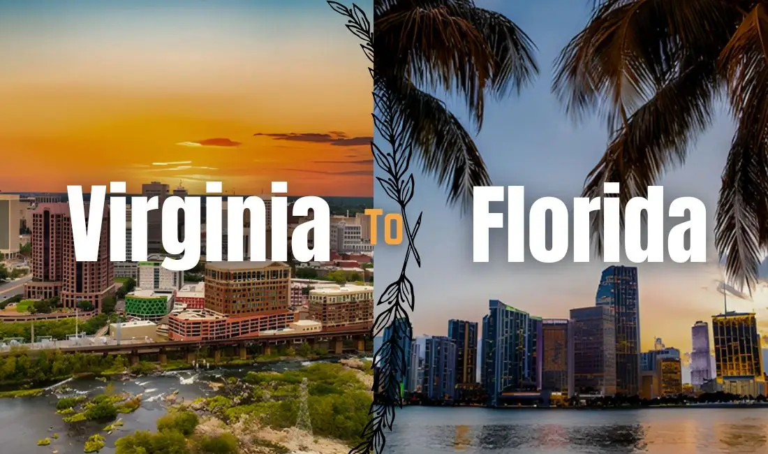
“How long is that drive, really?” — Every Virginia traveler who’s ever stared at a map before a Florida trip.
Most people want one number when they ask how far Virginia is from Florida. The truth? No such number exists. Where you start in Virginia changes the answer. Where you stop in Florida changes it again. And the way you travel rewrites it a third time. A driver heading from Richmond to Jacksonville faces nothing like the road ahead of someone leaving Northern Virginia for Miami.
This guide handles the question the way it deserves to be handled. Four travel modes get their own breakdown: car, plane, train, and bus. Each one comes with real distances, real travel times, and the kind of advice you only pick up after running the route yourself. Pair it with the interactive travel map guides to see your exact path before the trip begins.
The Straight-line Distance Between Virginia and Florida
Before we get into highways and flight paths, it helps to know the baseline. The straight-line distance from Virginia to Florida — what geographers call the “as-the-crow-flies” distance sits at roughly 861 miles or 1 386 kilometers depending on the two cities you’re comparing. Here’s a sense of the spread:
| From (Virginia) | To (Florida) | Straight-Line Distance |
|---|---|---|
| Richmond, VA | Jacksonville, FL | ~630 miles |
| Richmond, VA | Orlando, FL | ~850 miles |
| Virginia Beach, VA | Miami, FL | ~1,030 miles |
Nobody actually travels in a straight line, of course. Roads follow the landscape, flight paths arc through controlled airspace, and train tracks curve around cities and mountains. Every real-world route adds miles to these baseline figures — sometimes quite a few. But these numbers give you an honest frame of reference before we dig into the actual journey.
Also Read: How Far Is Alabama From Chicago?
How Far is Virginia to Florida By Car?
Driving is how most people make this trip, and for good reason. You control your pace, you control your stops, and the driving distance from Virginia to Florida — which typically falls somewhere between 861 miles or 1 386 kilometers is entirely manageable if you plan it well.
The Route Everyone Takes: I-95 South
Interstate 95 South is the main artery for this journey. It stretches nearly the full length of the East Coast, running from Virginia’s northern tip down through the Carolinas, across Georgia, and into Florida.
The driving is largely straightforward long, open stretches through pine forests and flat terrain and for the most part, it moves well outside of major city limits, Estimated under normal traffic conditions, without extended stops
| Starting Point (VA) | Destination (FL) | Miles | Drive Time* |
|---|---|---|---|
| Richmond, VA | Jacksonville, FL | ~690 miles | 10–11 hours |
| Richmond, VA | Orlando, FL | ~870 miles | 12–13 hours |
| Richmond, VA | Tampa, FL | ~940 miles | 13–14 hours |
| Richmond, VA | Miami, FL | ~1,110 miles | 15–17 hours |
| Northern Virginia (DC suburbs) | Orlando, FL | ~950 miles | 13–14 hours |
| Norfolk / Virginia Beach, VA | Miami, FL | ~1,080 miles | 15–16 hours |
Traffic Traps to Watch on the Virginia to Florida Drive
The mileage isn’t what wears you down on the Virginia to Florida drive, the cities are. Four chokepoints stand between you and a smooth run south: Washington DC, Richmond, Raleigh, and Jacksonville. Each one can swallow 30 to 60 minutes of your day if you roll through at the wrong hour, and hitting two or three back-to-back can stretch a 14-hour drive into something closer to 17.
Washington DC and Richmond Slowdowns
First, Washington DC sets the tone. The I-95 corridor through Northern Virginia jams up by 6:30 a.m. on weekdays and stays ugly until well past 9.
Evenings also run from 3 p.m. to 7 p.m., and Friday afternoons are their own category of pain. Richmond gives you a shorter window of trouble, but the I-95 and I-64 split catches a lot of drivers off guard during rush hour.
Raleigh and Jacksonville Bottlenecks
Raleigh is where most road trippers lose the most time. The I-40 interchange punishes Friday afternoon traffic harder than anywhere else on the route, and weekend backups creep in earlier than you’d expect. Jacksonville rounds out the list, with I-95 narrowing and merging right as you cross into Florida, often at the exact moment you’re tired and ready to push through.
The fix is simple: leave before 7 a.m. if your schedule allows, or time your city passes for mid-morning through early afternoon. Sunday mornings and mid-week departures shave the most minutes off the total. If you must drive on a Friday, plan to clear Raleigh before noon or after 7 p.m., never in between.
How to Beat Virginia to Florida Traffic
The fix is simple. Leave before 7 a.m. if your schedule allows, or time your city passes for mid-morning through early afternoon.
Sunday mornings and mid-week departures shave the most minutes off the total. However, if you must drive on a Friday, plan to clear Raleigh before noon or after 7 p.m., never in between.
Virginia to Florida Without I-95: Two Scenic Route Alternatives
I-95 gets the job done, but it wears on you. Mile after mile of identical green signs, the same chain restaurants, and asphalt that blurs together.However, if you’d rather see the South instead of passing through it, two alternative routes turn the Virginia to Florida drive into something worth remembering.
US-17 and US-301: The Inland Route South
First, consider US-17 paired with US-301. These highways run parallel to I-95 but pull you into the older bones of the South.
For example, expect smaller inland towns, courthouse squares, and farmland that looks frozen around 1955. Furthermore, you’ll roll through Tarboro, Walterboro, and Folkston, towns most travelers blow past without ever knowing they exist.
US-1: The Original Coastal Highway
Next, there’s US-1, the road I-95 replaced. Before the interstate system, US-1 was the way south, and most of it still exists along the coast.
As a result, the pace is slower. Speed limits drop often, and stoplights replace exit ramps. Still, you get character no interstate can match.
Which Virginia to Florida Route Fits Your Trip?
So which one fits your trip? First, pick US-17 and US-301 if you want a taste of the inland South without losing your timeline. Otherwise, choose US-1 when the drive matters as much as the destination.
Finally, both routes connect back to I-95 easily. So you can mix and match: scenic stretches where it counts, interstate where it doesn’t.
Interesting Read: How Far Is Dunnellon from Ocala, Florida?
How Far is Virginia to Florida By Plane?

If a 13-hour drive sounds less like a road trip and more like a test of endurance, flying is the obvious answer. The flight distance from Virginia to Florida covers the same ground in about 1.5 to 2.5 hours in the air on a direct flight a radical difference from the car.
The Main Airport Pairings
| Virginia Airport | Florida Airport | Flight Time (Direct) |
|---|---|---|
| Reagan National (DCA), Arlington | Miami International (MIA) | ~2 hrs 30 min |
| Dulles International (IAD) | Orlando International (MCO) | ~2 hrs 10 min |
| Richmond International (RIC) | Tampa International (TPA) | ~2 hrs |
| Norfolk International (ORF) | Fort Lauderdale (FLL) | ~2 hrs 15 min |
Here’s the math on flying, though: the flight is just one piece of the clock. Add getting to the airport 90 minutes ahead, clearing security, boarding, taxiing, deplaning, waiting at baggage claim, and then ground transport to your actual destination — and that 2-hour flight is realistically a 5 to 6-hour door-to-door experience. It’s still faster than driving. But it’s not quite as fast as it looks on a boarding pass.
💡 Booking Tip
The Virginia–Florida corridor is one of the busiest winter travel routes in the country. Prices spike sharply from December through March when everyone is fleeing to the sun. If you’re traveling during that window, book 4–6 weeks in advance and use flight discount codes to keep the cost down. Midweek flights almost always beat weekend prices on this route.
Taking the Train from Virginia to Florida
There’s a particular kind of satisfaction that comes with a long train journey one that flying and driving can’t really replicate. Train travel from Virginia to Florida is undeniably slower, but it’s also the most relaxed way to make the trip. You can walk to the dining car, watch the landscape slowly change outside wide windows, stretch your legs, and arrive somewhere feeling like a person rather than a road-weary survivor.
Amtrak runs two trains on this corridor. The Silver Meteor and the Silver Star both depart from the Mid-Atlantic region, stop in Alexandria and Richmond, then travel south through the Carolinas, Georgia, and down into Florida.
| Amtrak Train | Richmond, VA to Miami, FL | Key Stops |
|---|---|---|
| Silver Meteor | ~22–24 hours | Savannah, Jacksonville, Orlando, West Palm Beach |
| Silver Star | ~24–26 hours | Raleigh, Columbia, Tampa, Orlando |
Yes, it’s a full day on the train. But for families with kids who need to move around, older travelers, or anyone who genuinely dreads airports, this is a legitimate and genuinely enjoyable way to get there. A sleeper cabin on the overnight run to Florida is one of those quietly memorable travel experiences. Book early — sleeper berths on popular departures fill up weeks in advance, and last-minute train fares aren’t cheap.
Going by Bus to Florida from Virginia
The bus doesn’t get much love in travel writing, but it earns its place on this list — especially if the budget is tight. The Virginia to Florida bus trip covers the same road miles as driving yourself, but someone else handles the wheel, and a ticket can cost as little as $30–$60 one way if you book ahead.
Greyhound, FlixBus, and Megabus all run on this corridor. The tradeoff is time: expect 18 to 26 hours of travel from Richmond or Northern Virginia down to Miami, with stops along the way. It’s a long sit, but modern buses are considerably more comfortable than their reputation — reclining seats, power outlets, Wi-Fi, and smooth interstate cruising.
This option works best for solo budget travelers, students, or anyone who wants to arrive in Florida without the cost or commitment of a car. Before you book, check current travel deals and promotions (best to check Travel Tweaks Offers) — bus fares on this route fluctuate a lot, and booking even a few days ahead can make a meaningful difference.
City-by-City Distance Reference: Virginia to Florida
Not everyone starts from Richmond. Here’s a broader city-to-city distance guide for Virginia to Florida travel so you can find your exact starting point:
| From (Virginia) | To (Florida) | Drive Miles | Drive Time |
|---|---|---|---|
| Richmond, VA | Jacksonville, FL | ~690 mi | ~10.5 hrs |
| Richmond, VA | Orlando, FL | ~870 mi | ~12.5 hrs |
| Richmond, VA | Tampa, FL | ~940 mi | ~13 hrs |
| Richmond, VA | Miami, FL | ~1,110 mi | ~15.5 hrs |
| Norfolk / Virginia Beach, VA | Orlando, FL | ~890 mi | ~12.5 hrs |
| Arlington / Northern VA (DC area) | Jacksonville, FL | ~760 mi | ~11 hrs |
| Arlington / Northern VA (DC area) | Miami, FL | ~1,180 mi | ~16 hrs |
| Roanoke, VA | Orlando, FL | ~880 mi | ~13 hrs |
| Charlottesville, VA | Tampa, FL | ~960 mi | ~13.5 hrs |
If you want to map your specific route with stopovers and points of interest built in, interactive travel map guides go well beyond what standard GPS apps typically offer for road trip planning.
Road Trip Tips and What to See Along the Way
If driving is your choice, the Virginia to Florida road trip has more going for it than just the destination at the end. The American South between Virginia and the Florida state line is genuinely interesting, and it rewards travelers who aren’t in too much of a rush.
Split the Drive It Makes a Real Difference
For anything more than a Richmond-to-Jacksonville run, plan to sleep somewhere in the middle. Pushing 900+ miles in a single shot isn’t just tiring it’s the kind of fatigue that compromises your judgment at the wheel. The natural midpoint falls around Savannah, GA or somewhere in the Myrtle Beach area of South Carolina. You’ll arrive in Florida with more energy left, which is the whole point of going.
Fuel Up Before Florida
Gas prices in Georgia and South Carolina consistently run a bit cheaper than those in Florida’s tourist corridors. Fill up your tank just before the state line —it’s a small habit that adds up over a long trip.
Don’t Blow Past These Stops
The I-95 corridor isn’t just fuel stations and fast food. Some of the most distinctive places in the American South are sitting right along this route, and even a few hours at any of these is worth it:
The Outer Banks, NC: This one requires a detour east from I-95, but it’s one of the most dramatic coastlines on the entire East Coast. Wild ponies roam the beaches, historic lighthouses, the Wright Brothers Memorial, and miles of windswept barrier island. Best treated as a full detour day, not a quick stop.
Charleston, SC :Charleston might be the single most charming city on the East Coast, full stop. Rainbow Row, extraordinary Low Country food, a historic district you could wander all afternoon without running out of things to see. If you’re splitting the drive into two days, this is the ideal overnight city.
Savannah, GA : Spanish moss, cobblestone squares, slow pace, and an effortless beauty that catches most people off guard. The food scene here punches well above the city’s size, and the riverfront at sunset is genuinely lovely. It’s almost exactly halfway between Richmond and Miami, which makes it a natural stopping point in every sense.
St. Augustine, FL :The oldest European-settled city in the United States sits just 45 minutes south of the Georgia border. Cobblestone streets, a working 16th-century Spanish fortress, and a history that predates the founding of the country by 200 years. For even more ideas on what to explore along the route, browse TravelTweaks’ destination guides.
Frequently Asked Questions – Virginia To Florida
Q. How many hours is Virginia from Florida by car?
A. It usually takes about 10–14 hours to drive, depending on your exact starting point in Virginia and destination in Florida.
Q. How far is Virginia Beach from Florida?
A. Virginia Beach to Jacksonville is roughly 700 miles — about 11 hours by car. Virginia Beach to Miami is closer to 1,080 miles, or 15–16 hours of driving.
Q. What is the closest Florida city to Virginia?
A. Jacksonville in northern Florida is typically the closest major Florida city to Virginia.
Q. Is it cheaper to drive or fly from Virginia to Florida?
A. It depends on gas prices, the number of travelers, and flight deals, but driving is often cheaper for families, while solo travelers may find good flight bargains.
Q. What states do you pass through driving from Virginia to Florida?
A. On the I-95 route, you’ll travel through Virginia, North Carolina, South Carolina, and Georgia before crossing into Florida.